Friday, May 05, 2006

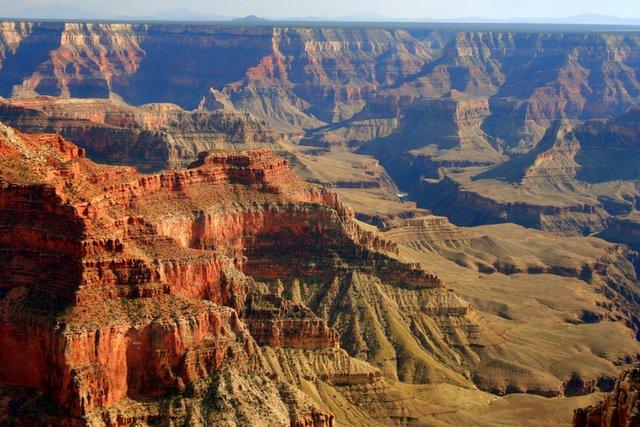
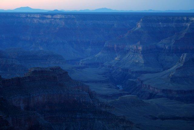
Thunder River and Deer Creek in Grand Canyon (May 2006)

This was Kim and my 17th anniversary trip for 3 nights and 4 days into the depth of the Grand Canyon, backpacking for almost 30 miles, experiencing some of the best parts of the canyon. We camped two nights in Tapeats Creek area, and one night in Deer Creek. Total distance was 10 miles day one; 3 miles day two; 6 miles day three; and 9 miles day four. Rim elevation is 7200' and the river is around 2000'. Dave accidently left about 1/3 of the food home and in the truck, so we rationed and lived on fewer calories. What a great weight loss program!


Thunder River cascading down. This river drops 1500' in one mile, and is the world's shortest river, and the only river that drains into a creek!


We can finally see our camp site down below at the left of the mouth of Tapeats Creek in the sandy area. Boaters are not allowed to camp here anymore, so we had it all to ourselves!


Our camp spot next to the river and Tapeats Creek.


Sunrise hitting tops of the canyon from our Tapeats Creek camp site.


The middle gorge is the narrowest part of the river through the Grand Canyon. On this day we hiked 5 miles from Tapeats to Deer Creek, with awesome views of the middle gorge.


View of Deer Creek Falls from the river.


Kim admiring the power of the water coming down Deer Creek Falls. We both swam in this cool water, as it felt good on a 90 degree day.


Dave at the mouth of Deer Creek Canyon above the waterfall and Colorado River.


King David sitting in the 'throne room'. Deer Spring gushing out behind him. This water was the best tasting water ever!

Tuesday, April 04, 2006

Taylor Creek (April 2006)

In the Kolob Fingers section of Zion, a 3 mile hike up Taylor Creek allows you to come to the double arch alcove, which has this unusual tree growing at the bottom.


Fingers of Kolob with blue sky and puffy clouds.

Saturday, March 25, 2006

Parashant Canyon (Mar 2006)

Parashant Canyon in the Grand Canyon is one isolated spot! I have been down there twice. I went down there in late winter by myself, and was worried that if something happened to me, that my best bet would be to try to get to the river in order to get help from rafters.

To get there, I drove my truck down road #1063 south of Bundyville School, and parked at the top of the rim near the stock tank. The road down into the canyon is in absolutely terrible shape. I have heard some people mountain bike down. I wouldn't do it--it's too steep, rocky, and slow. I took my motorcycle the 20 or some odd miles down to the copper mine, and I won't ever do that again either--way too many washed out ruts and big boulders. I averaged only about 8 mph both ways, and was in first or second gear most of the time. It was painfully slow.

I knew I was close to the copper mine when I saw a lot of green rocks scattered on the ground. From the copper mine it's easy to scramble down the wash and get into the narrows. Parashant does have some nice, deep, redwall narrows that go on for miles, and it's a fairly decent walk down to the river, although it too is a long ways.


Looking straight up while in the narrows.


A view down canyon.

Monday, March 20, 2006

East Zion (Mar 2006)

The east side of Zion has many side canyons and washes that are worth exploring. Many take you up on interesting slickrock and views.


Here is a slickrock highway that seems to go up into space.


These mysterious petroglyphs appear to be two humans joined at the feet, upside down.


Here are some humanoids riding on the back of a snake?

Sunday, March 12, 2006

Snow Spring Break (Mar 2006)


This was our backyard in the middle of March during Spring Break.


A hike up Johnson Canyon revealed a redrock face appearing to be eating a snow-covered tree.

The Wave of Coyote Buttes (Mar 2006)

Coyote Buttes is an area west of Kanab down on the Arizona state line. It is most famous for an area known as the 'Wave'. The BLM allows only 20 people in this area per day, so getting a permit to go out there can be quite an ordeal. I obtained a permit for the family and we hiked the 3 miles without any incidents. The colors, patterns, and shapes of the sandstone blows the mind away.


Brooke trying to comprehend the geometry of the rock.


Sasha on a portion of the Wave, shown here for size and scale.


Kim posing in front.


Notice the shimmering light colors.

Thursday, February 02, 2006

Zion Observation Point (Feb 2006)


A glowing wall rises 2000' above a lone ponderosa pine tree in Echo Canyon.


A raven in the foreground. Angels Landing and the Virgin River below.


A view of the main canyon from 2000' above the floor. It is a 4 mile hike up to this 'Observation Viewpoint'. Angels Landing is in the foreground.

Sunday, January 15, 2006

Kanab Point in the Grand Canyon (Jan 2006)


The view to the east From Kanab Point in the Grand Canyon.


This is a fantastic view of the Western Grand Canyon from Kanab Pt. Notice the Colorado River a shining a mile below.

Monday, December 12, 2005

Water Canyon (Dec 2005)

Water Canyon should actually be apart of Zion National Park, but it lies in Arizona next to the polygamist town of Hilldale. The hike I did follows the stream up into this narrow subway type section, then continues on for a total of about 4 miles up 2000' to the top of a slickrock paradise.


The cold winter day I went featured long frozen icicles in the subway section.


See the small stone at the bottom for scale of these wavy colorful ribbons of slickrock.

Saturday, November 12, 2005

South Canyon in Grand Canyon (Nov 2005)

Me hiking down into South Canyon, a side canyon of Marble Canyon in the GC. The hike is about 7 or 8 miles one way, and drops several thousand feet. I spent one night down there during a warm spell in November. Notice in the distance Vasey's Paradise spilling out into the river.


This is a shot from below of Vasey's Paradise. It is basically a huge spring that shoots out of the Redwall layer. There was a lot of poison ivy in this area. There is also a huge cave that nearby that has stick figures dating back several thousand years.


Sunday, November 06, 2005

West Rim Trail in Zion (Nov 2005)


For my 40th birthday, Kim and I went and stayed at the Zion Lodge, and did some hiking. Here we are enjoying the Fall colors on the trail up to Angels Landing.


Here I am standing in front of one of the stunning views of the West Rim.


Here's Kim on the slickrock trail leading down off the rim.

Monday, October 10, 2005

North Rim Grand Canyon wanderings about (Fall 2005)

I spent a couple of different trips out at the North Rim of the Grand Canyon with the family to enjoy the fall colors, and another trip with my friend Mike Burkley to do a backpack trip down to Cottonwood Campground and Ribbon Falls. Here are some of the best photos:


Fall colors along the North Kaibab Trail


Ribbon Falls, falling approximately 90 feet.


Me behind Ribbon Falls.


Sasha admiring red fall colors while hiking up the North Kaibab trail.


Brooke doing a little free solo rock climbing out on Camp Final Point.


Sasha posing at the top of the North Rim.

Monday, October 03, 2005

Snow Canyon secret petroglyphs (Fall 2005)


Not far from our home, these Anasazi petroglyphs are viewable only by climbing up a steep cliff to access a ledge. They are some of the most unusual petroglyphs around.


Hands or clans connected with energy or lightning?

Sunday, October 02, 2005

Sublime Point looking South (Oct 2005)

The 17 miles of dirt road along the North Rim to Sublime Pt is quite an adventure, and should not be attempted if the road is wet. But the views are great when you get there. I road my motorcycle out and camped at the point for one night.

Here is the view looking south in the afternoon from Sublime Point at the North Rim of the Grand Canyon. Notice Boucher Rapids.


Sunrise at Sublime Pt.


Blue sunrise!


Rainbow over the canyon!

The Subway in Zion (Oct 2005)


In October 2005, I hiked with my hiking buddy, Mike Burkley, 4.5 miles up the Left Fork or North Fork of the Virgin River, aka. 'The Subway'. This is a fun hike any time of the year, but is especially neat with the fall colors. It has dinosaur tracks, cascades, waterfalls, slots, swimming holes (great in the summer), slickrock, forests, plunge pools, and the famous subway-shaped tunnel slot.


Here we are posing next to an incredible series of cascades that runs the length of a football field.


Mike next to some leaves and a cascading waterfall.


The lower end of the 'Subway'.


Cascading plunge pools and forest above the slot canyon.

Boomer Hill (Fall 2005)


South of Santa Clara several miles there is a round mesa called Boomer Hill that rises 500' above the desert. Kim and I hiked out there and scrambled up the steep upper portion. We continued out to the southwest point, where there were these crazy plank-like rocks sticking over the edge. Kim practiced some yoga poses on the edge here.

Saturday, October 01, 2005

Fall Colors of 2005

Here are some shots of the color and the family in the mountains around Cedar City during the fall of 2005.


!-- Site Meter XHTML Strict 1.0 -->