Monday, February 22, 2010

Desert Hike Photos from Red Cliffs Desert Reserve (Winter 10)

Here are some photos (not necessarily the best quality) from my new Droid phone's camera.


The Donut Arch up on the north end of Red Mountain.


The Santa Clara River, from the Sidewinder Trail.


Rising cobra snake coming out of an agave plant!


Snow Canyon and Pine Valley Mountain, from the top of the Red Mountain.


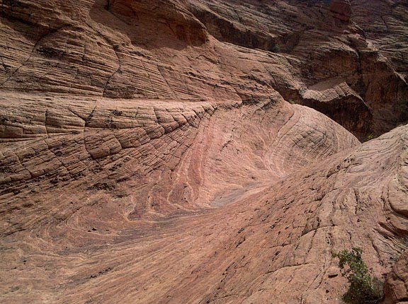
Slickrock formations above Tuacahn.


The "Vortex" (aka: the "toilet bowl") had water in it. The Camelback Peaks in the distance.


Camelback and a desert tank.


A slickrock dome in Washington Hollow.


Wave action on the stone in Yellow Knolls area.


Pools after a rain storm in Black Gulch.

Wednesday, February 10, 2010

Cathedral to Soap Float (Feb 10)


For a fun day trip, Mike and I drove our vehicles out to Marble Canyon, where we did a nice little hike down Cathedral Canyon to the river. Here is a shot of us inflating our little tiny packrafts, as we get ready to float 8 relatively calm river miles down the Grand Canyon until we reach a side canyon called Soap Creek.


This is the narrows of Cathedral Canyon.


A view of the Colorado River of Soap Creek Rapids.

Saturday, January 23, 2010

Snowshoeing up to Zion's Angels Landing (Jan '10)

Our state got hammered by some big blizzards that dumped multiple feet of snow in the mountains. This storm prevented Mike and I from doing a cross country ski trip with some other guys over to Yosemite's Glacier Point. We were disappointed to say the least. The high country of Zion was not spared from the storms either, and so we took advantage of an early morning departure to be the first ones up the Angels Landing trail to Scout Lookout, and even higher up on the West Rim Trail.


A view of Angels Landing from the trail below.


Multiple 'waterfalls' of snow (avalanches), crashed down around us as we hiked through Refrigerator Canyon.


A view of the river below, from the railing at Scout Lookout. The chains higher up to Angels Landing required some major digging in order to find them.


This footprint sign seems so out of place.


A view of the main canyon from the West Rim Trail. There was at least 3 feet of snow up here.


Mike and I agreed that this incredible snow with the views in Zion is probably not even beatable by what we could have experienced in Yosemite.


Video of Avalanche in Zion

Friday, January 15, 2010

Land Hill Petroglyphs (Jan '10)

Evidence of bighorn sheep that once lived in the area.

Sasha, Kim and I had a nice stroll one winter day down on the south end of Ivins, up a mesa named Land Hill. The edge of the mesa drops off to the south several hundred feet down a cliff to the Santa Clara River, where you can see signs of prehistoric farm land where the Anasazi raised crops like corn. During their free time, the natives would climb up the cliff to the top, where they would carve hundreds of pictures into the rocks. These petroglyphs cover the hill top side, and are quite interesting to walk around, look at, and attempt to guess what they mean.


Sasha near some rocks where some experts say was a birthing area for the women of old.

Friday, December 11, 2009

Red Mountain Cross Country Skiing (Dec 09)

We finally got some precipitation here--the first time this Fall--and it came down pretty heavy. We got a few inches of snow in our backyard, but up on top of the Red Mountain, there was over a foot of fresh powder. I drove up Highway 18 and cross country skied several miles out to the Snow Canyon overlook. Notice my tracks on the left side of the photo below. The pinion and junipers are nicely flocked. This is looking north towards Pine Valley Mountain.


Looking south from the Snow Canyon overlook.

Sunday, November 01, 2009

Zion Subway Hike and Photos (Nov 09)

Zion's canyons have some of the best Fall colors anywhere this time of year. I organized a group of 12 of us friends and family members to go hike up to the Subway to enjoy the beauty. Due to sickness, only 9 of us made it, but we had perfect weather conditions, and I was able to get some great photos.


Here is an attempt to make a semi- abstract HDR-style photo of the beautiful cascades.


We left the day after daylight savings ended, so we at least had an extra hour of sleep after our Halloween fun.


Brooke resting by one of many beautiful cascades.


Here's CJ, Brooke, Sean and Ryan entering the Subway tunnel.


Swirling pools of autumn leaves, slots of light, cool water--a cathedral in the desert!


The famous North Pole log still after so many years has never been washed down by a flash flood.


A heart shaped pool.


Another great shot.


A close up of a trough of running water.


Here's the group warming up in the sun for lunch.


Cool blue!

Sunday, October 18, 2009

Labyrinth Canyon Canoe Trip on the Green River (Oct 09)

View of La Sals and Canyonlands from one of five arches at the rim above Labyrinth Canyon.


October is a great month for Fall colors and floating in canoes down the gentle Green River near Moab. Mike B, Mike G, Bo and I completed the trip this year 45 miles down Labyrinth Canyon in canoes. Here we are at Ruby Ranch packing for 4 nights.


Silhouette of the other canoe floating past beautiful cottonwoods and red cliffs.


Another similar one.


Mike standing on the saddle atop of Bowknot Bend, where the Green River does an 8 mile loop back to where it practically started from.


Our third night camp on an island was not cold or wet, unless you account for a thick layer of dew covering everything by morning.


Our hike up 2 Mile Canyon had a great trail to the rim, and five different arches up on top.


The 2 Mikes paddling from our last night's camp on a nice sandy island.


Finally, we found the elusive Julien inscription dating from 1836.

Sunday, October 04, 2009

Circumambulation of Powell Plateau via a Packraft (Oct 09)

Above our Blacktail camp site.

I had been anxiously awaiting the time to do this trip down in the Grand Canyon, where Mike and I hike down the North Bass trail 14 miles to the river, then float, hike and portage our way downriver about 25 miles in a remote and wild section where the Colorado River does a near circle as it winds its way (circumambulates) around the massive mile-high Powell Plateau, which is named after John Wesley Powell, the first human to float the entire canyon. To get out of the canyon, we must hike 12 miles up and out via Tapeats Creek and the Thunder River trail, and then shuttle back to our original trailhead.

The weather was beautiful on the river. The first and last days of hiking were a little windy, and the only major trouble we had was driving back to get Mike's cars. Due to the wind storm, the road was blocked and requires a chainsaw to clear the downed trees. We had an incredible adventure, met lots of neat river runners, worked really hard (especially portaging), and had lots of fun.


Our first campsite is below Dox Castle, next to Shinumo Creek (bottom part of photo).


Sunset from Shinumo Creek camp site.


The second day we finally hit the Colorado River, just below Bass Rapids here in the photo.


Our second camp at Toltec Beach here has beautiful white sand.


The next day we visit probably the most incredible side canyon of all--Elves Chasm. Here I am next to the lower falls.


See the elf sitting high on the rock?


Upper Elves chockstone, and waterfall behind it.


Cascade and pool above Upper Elves.


Upper Upper Elves pool.


Upper Upper Upper Elves--the most beautiful! It took a lot of crawling and rock scrambling to reach all of the upper pools--an enchanted place that few people get a chance to see.


Our third night camp spot is here at Blacktail Canyon beach, looking downriver at Conquistador Aisle and the Great Thumb Mesa off in the distance.


A short afternoon and moonlight hike up Blacktail Canyon, where you can touch a missing gap of 1 billion years between the Tapeats and Vishnu rock layers.


The next morning this was our view as we got in our tiny packrafts to float 12 river miles.


We portaged about a dozen times, around some difficult rapids like Specter here. The packraft weighs only 4 lbs, the paddle, lifejacket and wetsuit each weigh 2 lbs.


This was in the beautiful Middle Granite Gorge section. A part of Powell Plateau can be seen in the distance.


Our last night at Stone Creek beach, none other than my neighbor in Ivins--Bev--from Steph's AZRA trip with me 5 years ago shows up with her group. What a reunion! We offer to share our beach in exchange for an incredible dinner and breakfast.


Stone Creek waterfall is a 5 minute hike from the beach.


Halfway up our hike out Tapeats Creek the last day, we take a nice relaxing break at Thunder River waterfall.


Our last night is up on the Esplanade, with incredible views of Powell Plateau in the distance, our Stone Creek beach (the small speck), Surprise Valley below, and the sunset light hitting the redwall.


On this trip, we each hiked with a total of 40 lbs. The hiking was very long, steep, windy, and hot. The paddling on the river was pleasant, but portaging numerous rapids is extremely exhausting. The most difficult portage was below Bedrock Rapid. We portaged okay past the huge boulder to put in at the lower part of the rapid, but had to deal with crossing two or three super strong cross currents and eddies that nearly slammed us into a wall, a rock, and a dead-end room-sized pocket. The river portion was surely beautiful though. And we met some great people.

Video of Mike jumping in Elves.
 
!-- Site Meter XHTML Strict 1.0 -->