Monday, July 23, 2007

Green River Raft through Lodore Canyon (July 2007)

This was a spur-of-the-moment trip that I came up with when we were home in the middle of hot Southern Utah July temps, and we all wanted to escape the heat. We talked about going to Europe, but just didn't feel right about it. I really wanted to get on the river again, so I researched some river trips, and decided that the Green River through Dinosaur National Monument's Lodore Canyon would be just the ticket. It turned out to be much, much better than any of us dreamed, and we decided it has been one of the best family vacations we have taken ever! The guides, the scenery, the river, the laid-back relaxed pace, the absence of high technology allowed us to disconnect from our 'real' world, and connect with our real, natural world, and with wonderful guides and friends that we made on the river. None of us wanted the trip to end, and were sad to say goodbye to the river and to everyone else.


Stephanie, Brooke, and Sasha entering the Gates of Lodore on the upper Green River in Dinosaur Natl Monument. We took turns switching with six different guides, and 3 duckies.


Lodore Canyon was full of interesting geology and faults like this.


Our second camp from up above.


Our last camp spot at Jones Hole.


"Chuck-a-deuce" Dewey and Caylin were two of our favorite guides.


Sasha getting poured on at waterfall near Jones Hole. People could sit in the chute above and dam the water for a short time, thus creating this deluge.


Our guides: Alison, Dewey, Caylin, Erica, Randy, and Greg, from Dinosaur Rafting Co.


Beautiful white sandy beach lunch spot in the middle of the canyon near where a proposed dam was fortunately shot down back in the 60s. The lake would have flooded the Green and Yampa Rivers.


Girls posing at Steamboat Rock, just downstream from the confluence of the Green and Yampa Rivers.


Stephanie and Brooke borrowing Cristoff's tandem kayak.

Friday, June 22, 2007

Lake Powell Family Trip (Jun 2007)

Five short, wonderful summer solstice days were spent with our family and the Perry family at Lake Powell. We enjoyed great meals, company, games, jet skis, tubing, kayaking, swimming, and laughing. The lake is only half full, but there is still plenty of water and beach areas.


Early sunrise coming up over the water.


Kids on the tube being pulled by the jet ski.


Kim paddling out on a quiet pre-dawn morning.


Kim practicing yoga on our favorite little rock island. Notice the kayak drifting away.


The kids and the dogs pose in front of Tower Butte. Jordan and Matt Perry in front.

Tuesday, June 12, 2007

Zion Narrows with Sasha (June 8, 2007)

I tried to get the whole family to go, but only Sasha wanted to do the Narrows with me. So we spent an entire day hiking all the way up to Big Spring and back. Sasha was extremely cold up to Orderville Canyon, and I thought we would turn around and go back, but she wanted to try going further. Soon thereafter, the air and water and Sasha warmed up, and she and I were the only ones up at Big Spring.


Sasha taking photos everywhere with her mind.


A cold break next to Orderville Canyon.


Classic rock blocking the river.


Sasha next to Big Spring.


Me up Orderville Canyon at the first waterfall.


Classic Narrows shot.

Friday, May 18, 2007

Old Bright Angel Trail (May 2007)

I got up at 4AM to drive to the North Rim and begin a 17 mile loop hike (with 4400' vertical down and up) across the Ken Patrick Trail 4 miles, down the Old Bright Angel Trail 6 miles, and 7 miles up the North Kaibab Trail back to the truck. This took me 8 hours total, including all breaks. The temp at the rim was 50'ish, and down at Bruce's house it was 90. It was a hot hike out!

From the rim looking down the Old Bright Angel Trail, which is not maintained at all. It was brushy, steep, and ledgey in many places.


Near the bottom, I walked on ledges above many pools and waterfalls.


I came 18 inches from stepping on this aggressive pink rattler! I was on a narrow ledge and almost slipped off of it into the above photo's pools.

Thursday, May 17, 2007

Rainbow Rim (May 2007)

After the long day on the Old Bright Angel trail, I drove out to Fire Point to spend the night. The next morning I rode my bike along the Rainbow Rim Trail, doing a 9 mile loop of Timp and North Timp points.


I slept in the bed of the truck on a quilt, and this was my view of the sun setting over the western Grand Canyon! I was all alone out on this point too!


From Fire Point, you can look off to the south and see Muav Saddle, the Bass Trail, and Powell Plateau.


A view from my mountain bike. Notice the little white vertical line and green speck in the middle--that's Thunder River!

Sunday, May 13, 2007

Wildcat Canyon Connector Trail in Zion (May 2007)

Typical view along the Wildcat Canyon connector trail from Hop Valley to upper Subway. The West Temple in the distance.

Friday, May 11, 2007

Awesome Chasm Overlook (May 2007)

Kim and I hiked up to a spot overlooking Red Mountain and Snow Canyon.


Sun Salutation yoga pose.


At the toll booth, a local guy showed us the gila monster he caught on his back porch.

Saturday, May 05, 2007

Zion West Rim Anniversary Hike (May 5, 2007)

For our 18th anniversary, we stayed in Springdale at the Majestic View Lodge, and did a 15 mile hike up the West Rim. We enjoyed outstanding views and beautiful weather.


Angels Landing behind me.


Kim doing the 'full wheel' variation of 'bridge' yoga pose.


Looking west off the West Rim Trail.


I was a little bit chilly up there after lunch.

Saturday, April 28, 2007

Virgin River Gorge hike (Apr 2007)

I hiked 5 miles from the freeway up into the Virgin River Gorge. There was not much of a trail, and I had to cross the river many times. It was very quiet (once I got away from the highway), solitaire and scenic, resembling a mini-Grand Canyon. Normally, this hike would be impossible this time of year due to spring runoff. This year is terribly dry.


Typical view.

Saturday, April 21, 2007

East Temple (Apr 2007)

I attempted to climb the East Temple in Zion as far as I could go, up above the Canyon Overlook trail. The capstone is quite vertical and looks like several pitches to get to the summit. I did get some nice photos of the canyon though.

Notice the steep slopes below me. I'm on the south side of the East Temple. The West Temple is in the distance.


Looking south towards Bridge Mountain Arch.


A lone twig on a slab of wavy slickrock.

Sunday, April 08, 2007

West Temple in Zion on Easter (Apr 8, 2007)

Easter Sunday 2007. Bo Beck invited me to go up to the West Temple. We start in a neighborhood of Springdale (elev 4000') before sunrise with headlamps, and climb up the route to Kinesava, then veer north up and up and up towards the highest peak in the main canyon part of Zion National Park. The West Temple is protected by sheer sandstone cliffs and ridgelines. The crux is a 5.7 climb 40' up to the shoulder's top. From there we hike across the flat shoulder and up a gully through Carmel capstone gully to where the radio towers are at the summit of 7800', for a total elevation gain of 4000' vertical. We almost stepped on a large rattlesnake at the V Notch. Even though the hike is only 8 miles roundtrip, it feels almost like I did a R2R in the Grand Canyon. It took 4:40 to get up and 3:20 to get down for 8.5 hours round-trip with a half hour break. This is a steep, very exposed, mentally exhausting, but extremely rewarding and spectacular hike/climb / adventure. The views on top are in all directions for many many miles. This is definitely one of the most challenging dayhikes I have ever done. Thank you Bo, for the great idea and opportunity!


A view from the top of the shoulder south, looking at Kinesava's summit.


A view from the radio towers northeast towards the main canyon.


Bo at the bottom after the hike. We are both happy to have completed it. We hiked up the very highest peak in the right hand side of the photo.

Monday, February 19, 2007

Nankoweap (Feb 16-18, 2007)

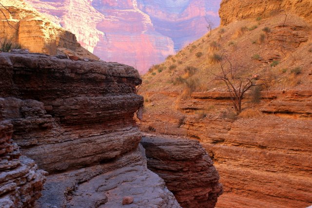
Grand Canyon! Nankoweap! Posted by Picasa


I decided to try this difficult hike at the spur of the moment when I heard that Kim's friend was coming to town for President's Weekend to go see the Parade of Homes. I went to the BLM to secure the permit from GC for three nights. The guy on the phone from the backcountry office wanted me to fill out a hiker information sheet giving my shoe type and size, etc. The BLM didn't have this sheet, so they just let me go, as is, and as a solo hiker. My itinerary was to hike down Nankoweap one night, go over to Kwagunt one night, then back to Nankoweap for the last night.

Friday morning I got up at 4AM and drove to the trailhead. The weather forecast showed a snow storm moving in on the last night, so I was considering shortening my trip to two nights. In the truck halfway there I realized that I had forgotten my first night's meal of chicken strips back home in the freezer. That was the deciding factor for me to just go 3 days and 2 nights. Fortunately, the road across House Rock Valley was dry and in good shape.

I got on the trail at 7:45 and started the 3 mile climb to Saddle Mountain, which is about 1000' in elevation gain. There was hardly any snow, just a few inches in patches, so the hike up the saddle was not difficult. An hour and a half later, after topping out I enjoyed the views, then started the 4 mile traverse through the Supai layer. This is a tedious part of the hike which requires full concentration. There are many boulders and shrubs and trees to go around, up and over. And there are many narrow ledges which are not difficult, but do require full concentration and slower steps. At one point the ledge narrows to six inches with a steep slope down about 10 feet before the cliff goes sheer down a thousand feet or more. Many hikers are intimidated at this point, but I didn't find it too difficult, even with a pack, because there are some nice flat ledges at waist high used for palming and mantling across this section.

After 2.5 hours of the Supai, I finally got on top of the Redwall on the Tilted Mesa ridgeline and enjoyed a quick lunch. The spectacular view here was in 300 degrees. I could see the river down to the east through Little Nankoweap Creek drainage. However, I was going to go down the west side of ridge towards the Nankoweap Creek drainage. This part of the trail was extremely steep--much like going down the gunsight trail off of Red Mountain. The loose rock made the going very slow and tedious, especially with a pack. On down through the redwall, switching back and forth, then doing the same through the Muav layer, then traversing a long ways in the Bright Angel shale--this is how it was going to be. There were a number of narrow sections of the trail here too, but without any handholds. The shale was small and compacted, so fortunately my footing did not slip. The important thing was to focus, take careful steps, and keep moving with balance and to watch the pack for shifts or bumps from obstructions.

Finally, after dropping 3,000' in 3 miles and 2 hours later I arrived at Nankoweap Creek, the first water in 10.5 miles. I took my boots off, put my feet in the creek, and relaxed under a nice cottonwood (no leaves on it yet) at a camp sight. I was debating on staying here the night, but I really wanted to get to the Colorado River. I had met one solo hiker in the middle of the Redwall as he was hiking out. He drove a compact Chevy to the trailhead, and had hiked down the previous night all the way to the river. Now he was on his way out--a very quick trip. He said that he was disappointed that Nankoweap Creek dried up down by the Colorado River, and he was unable to see or catch the trout run up it. It was only 1:45, and so I had plenty of time to meander the 3.5 miles down to the river. I finally got to the river about 8 hours after I left the truck.

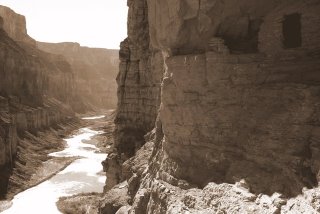
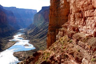
Sure enough, about 200 yards from the Colorado, Nankoweap Creek dries up. I turned right and hiked up a small hill that had some ancient walls of ruins intact. I looked across the delta and admired the view. I think this is the best view of the river in the canyon. There was a boat party camped down river a half mile to the right. I decided to walk straight ahead and camp at the foot of the main rapids on a nice sandy beach. That night I enjoyed a freeze dried rice and chicken dinner. The sound of the rapids is so soothing. It was easy for me to go to sleep by 7:30. I listened to half of 'Call of the Wild' on my Ipod.

The next morning after oatmeal, I hiked up 500' on the cliff above camp to the small granaries. This is where the river view is exceptional, as you can see nearly 8 miles of river through a beautiful, narrow marble canyon. Some of the boaters hiked up while I was coming down, and offered me to come to dinner. They were laying over for two nights to do some relaxing and exploring. I decided to dayhike and explore up Little Nankoweap drainage. It has some neat narrows with a little bouldering up and down.

I came back down and got my pack and said goodbye to the river, as I hiked up the creek 3.5 miles to the cottonwood tree camp spot. After setting up camp I continued up the creek another mile or so to check out the creek and the broad valley. There was a swimming hole that invited me in. The air temp was 70, and the water temp was not terribly cold, so I dunked myself and cooled off. On the way back to camp I looked for the horse thief trail that went up the south toward Nankoweap Butte. The trail continues over to Kwagunt and then on down to Lava/Chuar Valley. This is where horse thieves would take their stolen horses down Nankoweap, cross the Colorado, and ride up Tanner Trail on the south side of the canyon to escape posses.

That night after finishing a Chile Mac dinner, the temps were in the mid 40s, maybe a little bit warmer than when camping by the river. I finished 'Call of the Wild' and listened to a few tunes. Next morning after oatmeal I hit the trail by 7:30. It was slightly overcast, which helped keep the hot sun away. It was very long and strenuous, but I made it back to the truck 6.5 hours later. This is a very difficult hike, probably the most difficult one I have endeavored with a backpack. Some people say that North Bass is the most difficult, but I think Nankoweap is slightly more difficult. I did the North Bass a few months ago so it's fresh on my mind. If Nankoweap is a 10, then North Bass is a 9, on a scale of difficulty. These are the reasons why I think Nankoweap is more difficult:

1. No water for 10.5 miles
2. The 4 mile Supai traverse is very mentally exhausting
3. The Redwall descent is very loose and steep and mentally challenging. The Redwall in North Bass is steep too, but not as long.
4. Time required--it took me about 45 minutes longer to go the same distance and elevation compared to North Bass. This is most likely due to it being steeper in the Redwall, and more taxing through the Supai.

That being said, would I do it again? Most definitely, after a number of years have passed. I would like to explore Kwagunt and possibly get down to the Little Colorado, get ferried across by a passing boater, and then continue down the Beamer/Tanner trail out to the South Rim. I would also cache water on top of Tilted Mesa. I had only 2 liters with me, and I could have used a third one! Marion Seber seep was bone dry, compared to slowly dripping two years ago when I dayhiked down to check out the 'scary ledge' spot in the Supai.

Elevations:
Saddle Mtn TH: 6800'
Top of the saddle: 7600'
Tilted Mesa ridgeline: 6500'
Nankoweap Creek: 3600'
Colorado River: 2800'
Total Miles: 14 (day 1); 9 (day 2); 10.5 (day 3)

On the way home I drove over to Buck Farm overlook. This was a nice view right there from the road on the rim.

-dNally

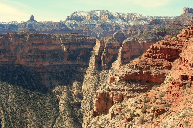
View West from Tilted Mesa


View south from Tilted Mesa. Nankoweap Mesa in the background.


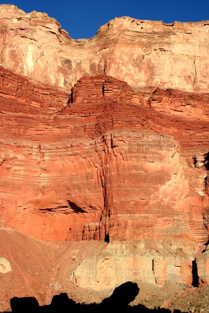
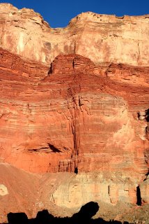
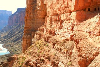
Cliff face from Colorado River and Nankoweap Creek.


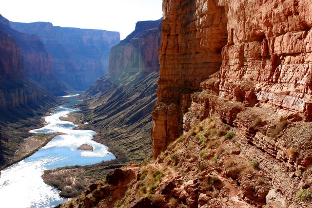
Colorado River from Nankoweap Ruins


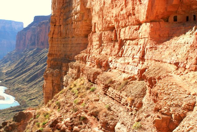
Ruins in Nankoweap


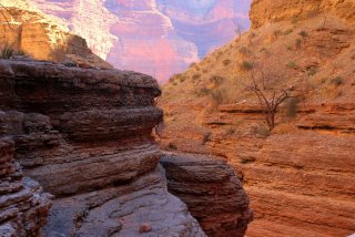
Narrows in Little Nankoweap Creek.
 
!-- Site Meter XHTML Strict 1.0 -->