Monday, February 19, 2007

Nankoweap (Feb 16-18, 2007)

Grand Canyon! Nankoweap! Posted by Picasa


I decided to try this difficult hike at the spur of the moment when I heard that Kim's friend was coming to town for President's Weekend to go see the Parade of Homes. I went to the BLM to secure the permit from GC for three nights. The guy on the phone from the backcountry office wanted me to fill out a hiker information sheet giving my shoe type and size, etc. The BLM didn't have this sheet, so they just let me go, as is, and as a solo hiker. My itinerary was to hike down Nankoweap one night, go over to Kwagunt one night, then back to Nankoweap for the last night.

Friday morning I got up at 4AM and drove to the trailhead. The weather forecast showed a snow storm moving in on the last night, so I was considering shortening my trip to two nights. In the truck halfway there I realized that I had forgotten my first night's meal of chicken strips back home in the freezer. That was the deciding factor for me to just go 3 days and 2 nights. Fortunately, the road across House Rock Valley was dry and in good shape.

I got on the trail at 7:45 and started the 3 mile climb to Saddle Mountain, which is about 1000' in elevation gain. There was hardly any snow, just a few inches in patches, so the hike up the saddle was not difficult. An hour and a half later, after topping out I enjoyed the views, then started the 4 mile traverse through the Supai layer. This is a tedious part of the hike which requires full concentration. There are many boulders and shrubs and trees to go around, up and over. And there are many narrow ledges which are not difficult, but do require full concentration and slower steps. At one point the ledge narrows to six inches with a steep slope down about 10 feet before the cliff goes sheer down a thousand feet or more. Many hikers are intimidated at this point, but I didn't find it too difficult, even with a pack, because there are some nice flat ledges at waist high used for palming and mantling across this section.

After 2.5 hours of the Supai, I finally got on top of the Redwall on the Tilted Mesa ridgeline and enjoyed a quick lunch. The spectacular view here was in 300 degrees. I could see the river down to the east through Little Nankoweap Creek drainage. However, I was going to go down the west side of ridge towards the Nankoweap Creek drainage. This part of the trail was extremely steep--much like going down the gunsight trail off of Red Mountain. The loose rock made the going very slow and tedious, especially with a pack. On down through the redwall, switching back and forth, then doing the same through the Muav layer, then traversing a long ways in the Bright Angel shale--this is how it was going to be. There were a number of narrow sections of the trail here too, but without any handholds. The shale was small and compacted, so fortunately my footing did not slip. The important thing was to focus, take careful steps, and keep moving with balance and to watch the pack for shifts or bumps from obstructions.

Finally, after dropping 3,000' in 3 miles and 2 hours later I arrived at Nankoweap Creek, the first water in 10.5 miles. I took my boots off, put my feet in the creek, and relaxed under a nice cottonwood (no leaves on it yet) at a camp sight. I was debating on staying here the night, but I really wanted to get to the Colorado River. I had met one solo hiker in the middle of the Redwall as he was hiking out. He drove a compact Chevy to the trailhead, and had hiked down the previous night all the way to the river. Now he was on his way out--a very quick trip. He said that he was disappointed that Nankoweap Creek dried up down by the Colorado River, and he was unable to see or catch the trout run up it. It was only 1:45, and so I had plenty of time to meander the 3.5 miles down to the river. I finally got to the river about 8 hours after I left the truck.

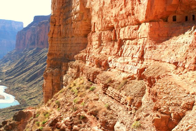
Sure enough, about 200 yards from the Colorado, Nankoweap Creek dries up. I turned right and hiked up a small hill that had some ancient walls of ruins intact. I looked across the delta and admired the view. I think this is the best view of the river in the canyon. There was a boat party camped down river a half mile to the right. I decided to walk straight ahead and camp at the foot of the main rapids on a nice sandy beach. That night I enjoyed a freeze dried rice and chicken dinner. The sound of the rapids is so soothing. It was easy for me to go to sleep by 7:30. I listened to half of 'Call of the Wild' on my Ipod.

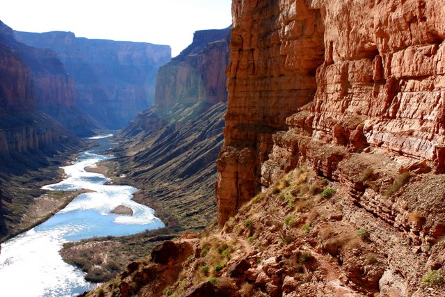
The next morning after oatmeal, I hiked up 500' on the cliff above camp to the small granaries. This is where the river view is exceptional, as you can see nearly 8 miles of river through a beautiful, narrow marble canyon. Some of the boaters hiked up while I was coming down, and offered me to come to dinner. They were laying over for two nights to do some relaxing and exploring. I decided to dayhike and explore up Little Nankoweap drainage. It has some neat narrows with a little bouldering up and down.

I came back down and got my pack and said goodbye to the river, as I hiked up the creek 3.5 miles to the cottonwood tree camp spot. After setting up camp I continued up the creek another mile or so to check out the creek and the broad valley. There was a swimming hole that invited me in. The air temp was 70, and the water temp was not terribly cold, so I dunked myself and cooled off. On the way back to camp I looked for the horse thief trail that went up the south toward Nankoweap Butte. The trail continues over to Kwagunt and then on down to Lava/Chuar Valley. This is where horse thieves would take their stolen horses down Nankoweap, cross the Colorado, and ride up Tanner Trail on the south side of the canyon to escape posses.

That night after finishing a Chile Mac dinner, the temps were in the mid 40s, maybe a little bit warmer than when camping by the river. I finished 'Call of the Wild' and listened to a few tunes. Next morning after oatmeal I hit the trail by 7:30. It was slightly overcast, which helped keep the hot sun away. It was very long and strenuous, but I made it back to the truck 6.5 hours later. This is a very difficult hike, probably the most difficult one I have endeavored with a backpack. Some people say that North Bass is the most difficult, but I think Nankoweap is slightly more difficult. I did the North Bass a few months ago so it's fresh on my mind. If Nankoweap is a 10, then North Bass is a 9, on a scale of difficulty. These are the reasons why I think Nankoweap is more difficult:

1. No water for 10.5 miles
2. The 4 mile Supai traverse is very mentally exhausting
3. The Redwall descent is very loose and steep and mentally challenging. The Redwall in North Bass is steep too, but not as long.
4. Time required--it took me about 45 minutes longer to go the same distance and elevation compared to North Bass. This is most likely due to it being steeper in the Redwall, and more taxing through the Supai.

That being said, would I do it again? Most definitely, after a number of years have passed. I would like to explore Kwagunt and possibly get down to the Little Colorado, get ferried across by a passing boater, and then continue down the Beamer/Tanner trail out to the South Rim. I would also cache water on top of Tilted Mesa. I had only 2 liters with me, and I could have used a third one! Marion Seber seep was bone dry, compared to slowly dripping two years ago when I dayhiked down to check out the 'scary ledge' spot in the Supai.

Elevations:
Saddle Mtn TH: 6800'
Top of the saddle: 7600'
Tilted Mesa ridgeline: 6500'
Nankoweap Creek: 3600'
Colorado River: 2800'
Total Miles: 14 (day 1); 9 (day 2); 10.5 (day 3)

On the way home I drove over to Buck Farm overlook. This was a nice view right there from the road on the rim.

-dNally

View West from Tilted Mesa
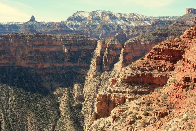


View south from Tilted Mesa. Nankoweap Mesa in the background.


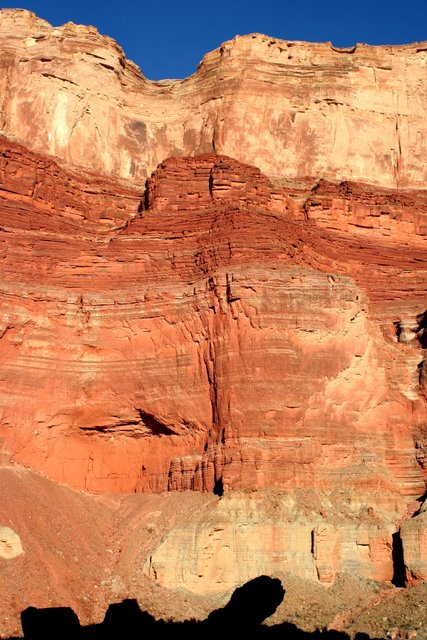
Cliff face from Colorado River and Nankoweap Creek.


Colorado River from Nankoweap Ruins


Ruins in Nankoweap


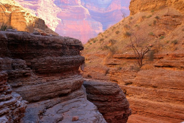
Narrows in Little Nankoweap Creek.
Monday, January 15, 2007

Bryce in winter (Jan 2007)

Bright red hoodoos covered with snow. This is how Bryce National Park is in the winter. The area is usually only accessible by cross country ski. But this year (Jan 2007) has been drier than usual, and the road was opened all the way to the end.


A tree with its roots hanging on the edge of a cliff.


Raven begging for food at the parking area of an overlook.

Thursday, January 11, 2007

West Rim winter (Jan 2007)

A day after a major storm in January, I hiked up the West Rim Trail 2 miles towards Angels Landing. I stopped at Scout Lookout, decided to not go across the chains, but instead went another mile or two up the West Rim Trail. The snow was magnificient, and I got some pictures up high looking down on Walter's Wiggles.


Look at the wiggles!


A view of the Northgate Peaks in winter.

Friday, January 05, 2007

Snow Canyon sandstone in West Canyon (Jan 2007)


In Jan 2007 I biked up West Canyon 4 miles (in Snow Canyon), and climbed up on some beautiful wavy layered slickrock.

Wednesday, October 25, 2006

North Bass (Oct 2006)


The North Bass trail is located west of the North Rim Lodge about 15 or 20 miles along some rough dirt roads. This trail is one of the longest and most difficult trails in the park. It starts at 7200' and drops a vertical mile to the river at 2000' in the course of 14 miles. I got a permit for 2 nights and 3 days, to hike solo. I have always been interested in doing this hike after I traveled out the rough, bumpy road to Swamp Point 5 years ago with Mike Burkley when we backpacked down the 3/4 mile trail to Muav Saddle and then up the other side to Powell Plateau. The North Bass trail turns south at the bottom of the Muav Saddle, and continues another 12 miles down 5000' to the Colorado River.

The trail drops down about 600' to Muav Saddle where Teddie's cabin is still intact. If you keep heading west on the trail, you can climb up to the Powell Plateau, which is a hike I did many years ago with Mike Burkley. The North Bass trail turns left here at the saddle and heads pretty much due south all the way to the Colorado River. In the last two years, the park's trail crews improved the section through the Coconino and Hermit layers. Now the trail switches back nicely all the way to the Supai layer. In the Coconino there is a small seep which I used on the climb out.

The trail through the upper layers has been rebuilt, and is not too bad, other than being steep. Once you hike into the Supai layer the trail does a little bushwhacking and a tiny stream appears. This continues until you arrive at the top of the Redwall, where a big pouroff blocks further passage. A rebuilt trail continues on the right side back up along the Supai layer for about 1 mile until you get ready to literally plunge down through the Redwall. This is the steepest and loosest section of the whole trail, and could be dangerous if you are not careful. Once at the bottom of the deep Redwall, water starts to flow again and the rock hopping begins for the next several miles all the way down through the Muav and Bright Angel layers. There are several bypasses that help you avoid pouroffs. There is a large pouroff at the top of the Tapeats which requires you to choose to go downstream, or stream right across the Tonto layer for a couple of miles on a restored trail. I chose the bypass route.

After 2 miles you come into view of Shinumo Creek from way up high and are required to switchback down about 500' to the floor of the canyon. This trail section is not bad either, and the views are spectacular. Once on the floor, the creek provides coolness and trees provide shade. I continued another mile downstream to the lower Shinumo camp site. This required crossing Shinumo Creek several times, but I never had to get my shoes wet. The lower camp is near Bass's old camp site, and many relics are left from a century ago. I slept well after eating some chicken and half a sandwich. I was in a very deep, remote section of the canyon. I was quite exhausted from hiking nearly seven hours, so sleep came easily. I awoke early and ate oatmeal, then hiked 1.5 miles up and over a 600' hill and back down to the Colorado River. I ran into a river party there. They were camped at the Bass beach and were just getting ready to eat breakfast. They invited me to eat and drink with them, and I would have, had I not already eaten a pretty large breakfast.

I was hoping to get down to lower Shinumo Creek waterfall, but there is no way to continue along the Colorado River without swimming. So I hiked back to my camp site, picked up my pack and hiked upstream a mile. I dropped off my pack at the campsite at the bottom of the Tapeats part of the trail, then continued dayhiking up Shinumo Creek to the confluence of White Creek. I turned north and went up White Creek a mile or so. The water flow here was fairly small, but there were many pools and small climbs which needed to be negotiated. This was a beautiful, narrow gorge that consisted of mostly Vishnu Schist. A couple of waterfalls were present too. I went back down to Shinumo and tried going up that, but was stopped after a few minutes by narrow walls. I could have continued only if I wanted to get my feet wet. Back by the confluence I took a dip in a pool to cool off. That was only about the fifth time I had swam during the 95 degree heat the last two days. I noticed a faint trail going up to the South. I thought maybe there was a camp site up there. Instead, I found an Anasazi village area. There were four or five ruins that had only the base of their walls standing. Several granaries existed up in the cliffs too. I saw old pine nuts and small corn cobs.

That night I slept under the stars and was awakened around midnight by a lizard or mouse running across my neck. The next morning I got up around 6AM and started hiking up the Tapeats in the dark. I wanted to beat the sun as much as possible. I hiked quickly uphill until I arrived at the top of the Supai. Then I ran out of fuel and water, and the sun was beating down on me. I slowly got myself out of the canyon in about 5.5 hours, which is not too bad, considering this is definitely one of the most difficult trails in the canyon. The fall colors were very brilliant on the way home in the Kaibab forest. I was relieved to arrive home. I had seen nobody while down in the depths of the canyon for those three days. It was a very spectacular area and had a great feeling to it.

Sunday, October 22, 2006

R2R2R across the Grand Canyon (Oct 2006)

Kim really wanted to try a rim-to-rim (R2R) in the Grand Canyon. I had done one back in 2003--actually a R2R2R in two days and one night. I suggested we do a R2R2R instead, and save the time and gas it takes to shuttle two cars back and forth between the rims. We trained by hiking some big hikes and mountains. We started at the North Rim and hiked down 14 miles and 6000' vertical to Phantom Ranch in about 5 hours, after stopping off at Ribbon Falls. After eating a bagel and drinking some lemonade, we hiked up a vertical mile in 7.5 miles to the South Rim in another 4 hours. We took the shuttle to the store to buy some snacks, then off to the lodge for dinner and sleep. It was nice to get a warm shower before getting up at 5AM and repeating the 22 mile hike back across the canyon in about 9 hours. Kim loved it so much that she wants to do it again!


Kim rehydrating on the South Kaibab trail.


The Kaibab suspension bridge across the Colorado River.


The sunset from the Bright Angel Lodge after a long day's hike. One more day of hiking to go!


Kim happy as ever on the second day.

Right Fork of Virgin River "Double Falls" (Oct 2006)


A clear pool that must be swam or traversed in order to get above the narrows in Right Fork.


This is the reward after a long 7 mile hike up the Right Fork of the North Fork of the Virgin River. Double Falls is one of the most beautiful places in Zion National Park.

Wednesday, October 11, 2006

Grand Canyon Widforss Trail (Fall 2006)


This is the view from the end of the 5 mile Widforss Trail, which is located on the North Rim of the Grand Canyon. The trail is relatively flat as it meanders through a beautiful forest. The South Rim can be seen more than 10 miles in the distant horizon.

Saturday, September 23, 2006

Angels Landing (Sep 2006)

For a Fall family activity, Sasha decided she really wanted to hike up Angels Landing in Zion. Here are the girls on the Walter's Wiggles section. There are 21 wiggles in all.


Sasha and Kim looking up into the sun on the steepest portion of the trail. Chains can be used for aid. Many people have fallen 2000' to their death in this area, but not us.


Dave happy to be on top.


Sasha and Kim at the summit.

Friday, September 15, 2006

Parunaweap Canyon in Zion (Fall 2006)

Hiking this difficult 4 miles up a canyon past the Checkerboard Mesa, across endless slickrock, and down a steep crack gets you access to the upper portion of the East Fork of the Virgin River. This area is known as the Barracks, and resembles the popular Narrows, but has very few people visit this canyon due to its remoteness. Notice the silver 'sheen' on the wall above the water. There is a series of waterfalls downstream from this point.

Tuesday, August 22, 2006

North Guardian Peak in Zion (Aug 2006)

This is a nice cool hike high up in Zion National Park. Once on top of the peak you can look straight down into the Subway's canyon! Notice the South Guardian Peak in the upper right corner. It's almost a replica of the North Guardian.


A ponderosa pine tree growing straight out of the rock on top!


The subway is way down below.

Tuesday, August 08, 2006

Tuckup Shaman Pictographs (Aug 2006)


This large panel of pictographs and petroglyphs is located in the Grand Canyon's remote Tuckup Canyon drainage off of the north rim. The drive out there from St George is on a long and rough dirt road. This panel is preserved due to it being in a protected alcove, and is believed to date back more than 5000 years ago. Backpackers who sleep near the panel vow that they never will do that again in their life, because they hear and feel things (ghosts?) during the long miserable night long.

Tuesday, August 01, 2006

Kanarraville Canyon (Aug 2006)


The family hiked up Kanarraville Canyon a couple of miles to this beautiful waterfall spot, where it's impossible to proceed unless you climb up the makeshift log ladder. This is a very narrow canyon that should be avoided in flash flood times. Thunder clouds moved in, and we moved out quickly.


A shot of Brooke and Sasha a year ealrier, when we did this hike the first time.

Thursday, June 01, 2006

Grand Canyon Raft Trip with Brooke (June 2006)


This was my second trip down the river. The first one I did with Stephanie in June 2004. Now it was Brooke's turn, and she was unsure about the whole ordeal. Once school was out, I think she would have rather spent some times relaxing and playing with her friends. So here it was three days after school let out, and we got up very early to drive to Marble Canyon, where the Hatch River Rafting warehouse was. This is where we met our group. They drove us 10 miles to the put-in at Lee's Ferry, and the fun began.


We stopped here on some neat Supai ledges with beautiful and calm green-blue waters for our scenery. Brooke was amazed at how beautiful the water and the canyon was.


This is a nasty hole in House Rock Rapids. We stopped here to go hike up Rider Canyon. Brooke fell in a huge quick sand/ mud hole, and was covered with warm gooey mud up to her chest. She lost one of her sandals, and despite our guideBen looking forever, he never found it. When we got back to the boat, we witnessed a private raft hitting the rapid here and flipping. We ended up helping them flip back over before proceeding down canyon.


This is Vasey's Paradise, which is a spring springing from a cave much like Thunder River. There's a lot of poison ivy in the area, so we didn't get too close. I have backpacked down to this spot, and it's very serene.


We spent a lunch here in the Redwall Cavern. This is an enormous cave-like area that is large than a football field!


What a beautiful campsite at North Canyon! Brooke can be seen off in the distance, bathing in the river.


After a couple of day, Dave and Brooke are in the zone--one with the canyon here during a hike to this beautiful waterfall in North Canyon.


Calm reflective waters before getting to Nankoweap Canyon.


Brooke's favorite view of the river is from 700 feet above, next to the Nankoweap ruins.


Brooke cooling off in a waterfall in Clear Creek Canyon. Our weather in the canyon consisted of 95 degree days and 70 degree nights! Some nights were cooler and some days were a little warmer.


The Powell Plateau from our 'ledges' campsite below the Bass Canyon. This was Brooke's favorite place to camp.


The two of us posing in front of Elves Chasm, just before we jumped in, swam behind the rocks, climbed up, and jumped down 10 feet into the deep, cool waters!


A group photo in the part of the canyon know as 'Conquistidor Aisle'.


We were in the canyon during the New Moon, so the stars were incredible. This is a time exposure pointing up from our camp site at Upset Rapids.


Brooke swimming in the warm turquoise waters of Havasu Creek. This place, as well as the entire trip, was paradise on earth!


Brooke's number one favorite spot in the Grand Canyon--Deer Creek Falls!
 
!-- Site Meter XHTML Strict 1.0 -->